


Please use this identifier to cite or link to this item:
http://www.infoteca.cnptia.embrapa.br/infoteca/handle/doc/995283| Title: | MAPA de cobertura vegetal e uso da terra do Município de Capixaba, Estado do Acre. |
| Date Issued: | 2001 |
| Citation: | [Belém, PA]: Embrapa Amazônia Oriental, 2001. |
| Thesagro: | Cobertura vegetal Uso da terra |
| Keywords: | Capixaba Rio Acre Rodovia BR - 317 Acre |
| Type of Material: | Mapas |
| Access: | openAccess |
| Appears in Collections: | Outras publicações (CPATU)  |
Files in This Item:
| File | Description | Size | Format | |
|---|---|---|---|---|
| CoberturaVegetaleUsodoSolodoMunicipiodeCapixaba.PDF | 1,54 MB | Adobe PDF | 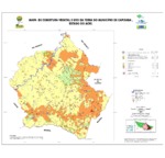 View/Open |


