


Please use this identifier to cite or link to this item:
http://www.infoteca.cnptia.embrapa.br/infoteca/handle/doc/991411| Title: | MAPA de cobertura vegetal e uso da terra do Município de Inhangapi - Pará. |
| Date Issued: | 1999 |
| Citation: | [Belém, PA]: Embrapa Amazônia Oriental: SUDAM, 1999. |
| Thesagro: | Cobertura vegetal Vegetação Uso da terra |
| Keywords: | Inhangapi Rio guamá Igarapé Inhangapi Pará |
| Notes: | Parte de: VALENTE, M. A.; SILVA, J. M. L. da; RODRIGUES, T. E.; SANTOS, P. L. dos; CARVALHO, E. J. M.; ROLIM, P. A. M.; SILVA, E. S.; PEREIRA, I. C. B. Zoneamento agroecológico das terras do Município de Inhangapi, Estado do Pará. Belém, PA: Embrapa Amazônia Oriental, 2001. 51 p. il. (Embrapa Amazônia Oriental. Documentos, 121). |
| Type of Material: | Mapas |
| Access: | openAccess |
| Appears in Collections: | Outras publicações (CPATU)  |
Files in This Item:
| File | Description | Size | Format | |
|---|---|---|---|---|
| Doc121mapa4.pdf | 1,24 MB | Adobe PDF | 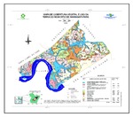 View/Open |


