Please use this identifier to cite or link to this item:
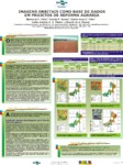
http://www.infoteca.cnptia.embrapa.br/infoteca/handle/doc/568324| Title: | Imagens orbitais como base de dados em projetos de reforma agrária. |
| Authors: | VILELA, M. de F.  SOARES, V. P.   F. FILHO, E. I.   RIBEIRO, C. A. A. S.   PEREIRA, R. de A.   |
| Date Issued: | 2004 |
| Citation: | Planaltina, DF: Embrapa Cerrados, 2004. |
| Thesagro: | Sensoriamento Remoto Reforma Agrária Satélite |
| NAL Thesaurus: | Landsat remote sensing |
| Keywords: | Satelites Agrarian reform Imagem |
| Type of Material: | Folders |
| Access: | openAccess |
| Appears in Collections: | Folder / Folheto / Cartilha (CPAC)  |
Files in This Item:
| File | Description | Size | Format | |
|---|---|---|---|---|
| p200440.pdf | 2.48 MB | Adobe PDF |  View/Open |


